

If you notice we are dressed warm. It will be a cool day.
Why cool, you ask? Those are BIG chunks of ice, or hanging glaciers, over Resurrection Bay.

As you can there is ice everywhere.

And it is the glacier blue ice.


Heading out the Bay.

This is Mt Marathon. It is said that two sourdoughs were in a bar arguing the you couldn't make it to the top and back in an hour. So a race was make and now they do it every 4th of July with a bunch of runners trying to beat the hour. I don't know if they do or not. I didn't.


A couple of nice waterfalls come down off the hills.
A few landmarks ahead you have all heard of, so now you will see.

Thumb Mountain

Caines Head

Chavel Island

Bear Glacier, we will see more of that.

Pauline with Bear Glacier in the background. Is she cool or not?

Camerals Point

Pilot Rock in the distance

Rugged Island, honest, that was its' name.

We had company for a while. Those critters coming are Dall's Porpoises. And they are quick divers, very hard to get a picture of.


Almost as if they were trying to race us.

We saw whales but not close.

We found where some of those fishing boats were going.

Peeked in the control room and saw the busy pilot.


This is also part of Aialik.
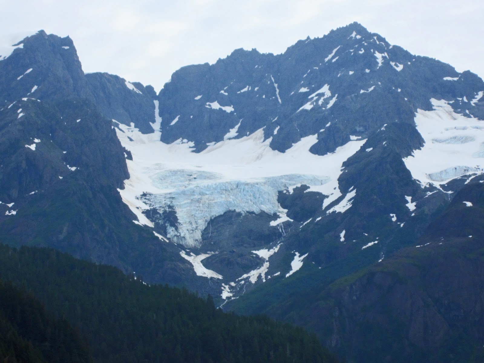
All but one of the glaciers we will see comes off the Harding Icefield, the second largest in the world.

This is a piece of it hanging over the edge of the mountain range that Harding Icefield covers.


Is this a cave or a rock? I didn't notice while we were there. Thought it was a rock. Maybe a cave going to a rock. Other pictures I have seen shows a rock. None say it is a cave. So your guess is as good as mine.

This rock is getting worn smooth.

Leaving Aialik Glacier.

When we left Aialik to go to Holgate we saw this other Glacier in the distance . It is Pedersen Glacier and I guess they did not have time to see them all, but notice the Icefield above it. Still part of Harding Icefield.
The Harding Icefield is well worth the read at http://en.wikipedia.org/wiki/Harding_Icefield.

On the way to the next Glacier you can see how cool My Dear Bride is and how much fun she is having.

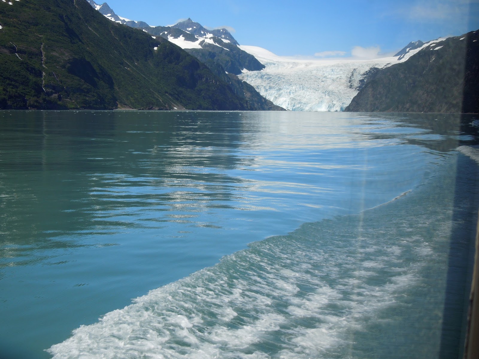
This is the Holgate Glacier. There was a very cold wind coming off it; wonder why.
We did stick around for a while then headed back toward Seward. It got a little warmer.

Here is a small raft of Sea Otters. Fun to watch.

You can see why they are called the Old Men Of The Sea.

A little information on Sea Otters: They are not fat to keep warm like seals, Sea Lions, etc. So instead they have very warm fur. There are so many hairs per square inch covering their body that the cold can't get to it. It's also why they were almost hunted to extinction for their fur. The way they live: They groom their fur, eat, and play. Once again a good read.
http://en.wikipedia.org/wiki/Sea_otter
.jpg)
We saw a few other critters, but these we see at home too.

Sea lions enjoying the sun

Chuck enjoying the sun.....


As we get closer we see more. Why does the name "Titanic" keep popping into my mind?

 It is pretty and big. Not to long ago it was all the way out to here. They are all receding due to less snow in the winter and warmer summers.
 We saw Bear Glacier a lot of different angles. All impressive.


The last day we planned to be in Seward; we are going to visit yet another Glacier. This is not a tidewater glacier but a Valley glacier. See if you can figure out the differences.
As I said before Harding is a big, big Icefield. The Harding Icefield can claim to cover over 300 square miles in its entirety (although, if one were to count its glaciers which descend from the icefield in all directions, the icefield measures in at over 1,100 square miles. There are over 40 glaciers that come off of it--like a huge bathtub of ice overflowing. So people go up on the ice to explore and find it is harder to get off than on. Exit Glacier got its name for being the easiest way to get on and off the Icefield. Don't ask me why they would do this in the first place.
Exit Glacier is a short trip off Seward Highway and they do have a Visitor Center. Here was a great relief map of the glaciers and the icefield.

We found as we toured the visitor center that there was a walk planned lead by a volunteer who knew a little about the area so of course we had to go with him.


Exit Glacier and Resurrection River. All the water in the river does not come just off the Exit glacier. There are other hanging glaciers and the ice field is just above, all of which contribute to the flow.

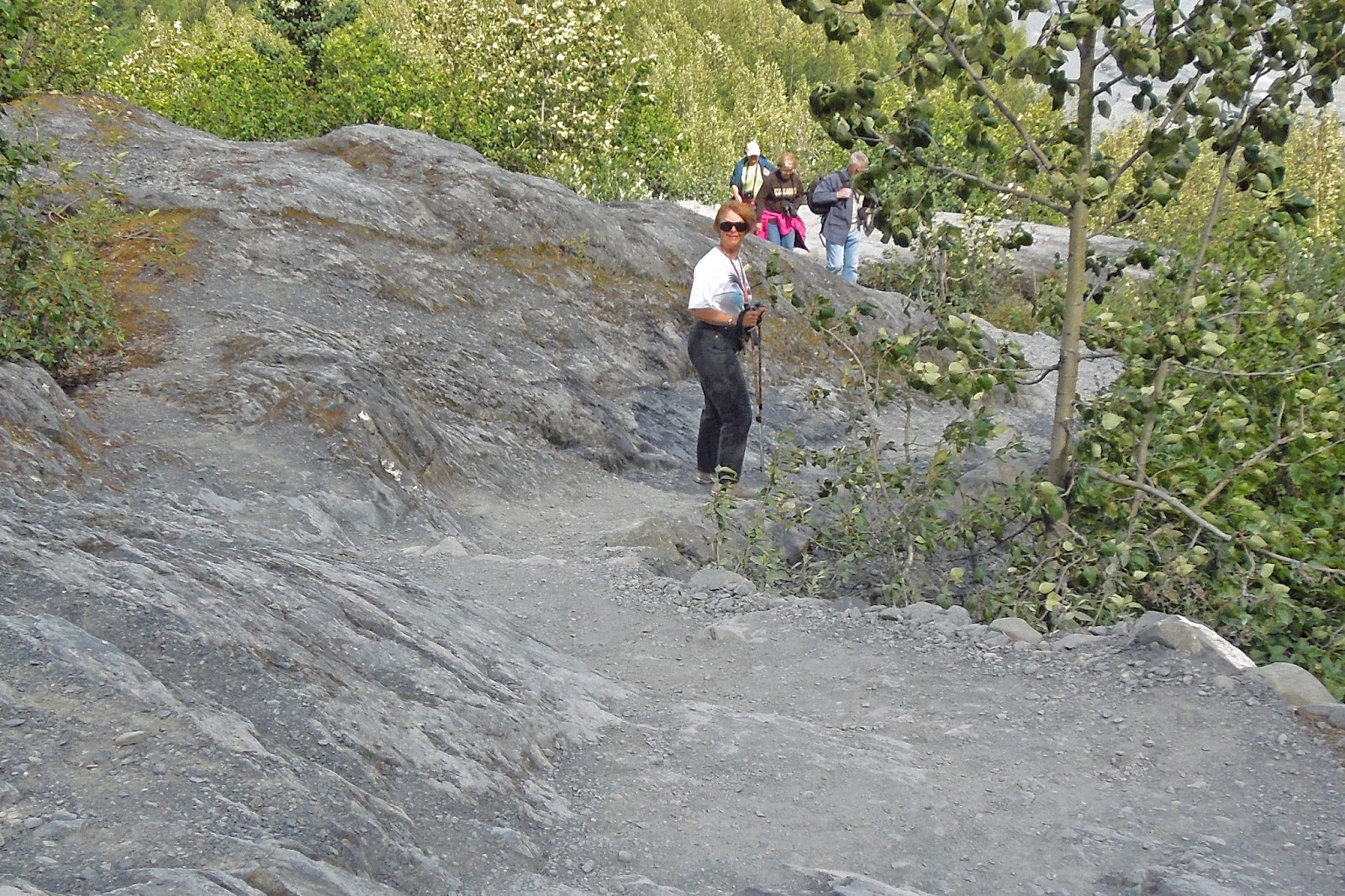
We had planned to only go up far enough to get a good look at the glacier then come back. But then we saw the trail and thought, "It should be easy to go up and get really close, and see, and hear." So off we went, without our jackets, which were way back in the car. Now, you ask, just how long have you been in Alaska? Don't you know that glaciers are big pieces of ice and ice is cold? And when there is a wind blowing down off it, it becomes cooler. All I have to say to that is-- Don't ask!

Fairly nice trail, only 4 or 5 (Chuck) miles long (yes, just 1.5 mi.), up in both directions. (How's he do that?) And the hat is strapped on.

This is the ice up close.


Here we are on the trail up next to an information poster. I have often wondered what they would do when the glaciers starts getting bigger and takes out all these up close posters. There were several--and quite informative.

We made it; now we have to go back.

On the way back I thought I would show you how smooth the glacier has worn the rock. Who knows how many times it has been back and forth over this rock.
Here I am, waiting for My Dear Bride to catch up with me....

Good picture of the rock trail, nothing fancy.

The last mile or so near the VC the trail is wheelchair accessible. It just goes to a distant view of the glacier.
When we got to the VC and the Honda we headed back but stopped for a "few, just a couple" more pictures of
Guess what????

Roadside Cow Parsnip & Fireweed

Fireweed, Epilobium angustifolium, is Alaska's ubiquitous summer season calendar. When the flowers bloom all the way up to the top of their stalk, summer's about over!

More magenta colored, beautiful Fireweed..........
Another eventful day with different views. Tomorrow we will leave and head to--where are we going? Come back later and maybe we will both know where we are going . . .
No comments:
Post a Comment